Piedmont Italy Map: Langhe, Roero And Monferrato Explained
Piedmont is a large region of northwest Italy, but almost every visitor only ever sees one corner of it: the wine hills south of Turin. This page explains the map, where each zone sits, and how close together the famous villages really are.
 By Chiara Barbero, Piedmont Bike Tour Guide and Langhe Cycling Specialist
Short answer
Piedmont sits in Italy's northwest, framed by the Alps and France, Switzerland and the Po valley. The wine zones, Langhe, Roero and Monferrato, lie south of Turin across the provinces of Cuneo, Asti and Alessandria. Alba is the natural hub: Barolo, Barbaresco, Neive and La Morra all sit within about 16 km of it.
Piedmont is one of Italy's largest regions, yet the villages most visitors come to see occupy a triangle you can drive across in under an hour. That mismatch is why a map matters more here than in most Italian regions. People search for a "piedmont italy map" and find either a wine-region marketing graphic or a blank provincial outline, neither of which answers the real question: where am I going to sleep, and how far is the riding from there?
This page fixes that. It uses verified distances, elevations and boundaries, the same figures that drive the route planning on Piedmont Bike Tours, to explain where the Langhe, the Roero and the Monferrato actually sit, how they differ under a bike wheel, and which one suits your trip. If you want the short version first: Alba, at 179 m above sea level in the Tanaro valley, is the hub, and every famous Barolo or Barbaresco village sits within about 16 km of it.
Where Exactly Is Piedmont On The Map Of Italy?
Piedmont occupies the whole northwest corner of Italy, ringed by the Alps on three sides and bordered by France and Switzerland. Its capital is Turin, in the north of the region on the Po plain. The wine hills, the reason most cyclists come, lie 70 to 90 km further south, around the towns of Alba, Asti and Canelli, well away from the mountains.
The name means "foot of the mountains", and the geography earns it. The Alps curve from the French border in the west around to Switzerland in the north, and the region slopes down from them onto the Po valley, the flat corridor that runs east toward Milan and the Adriatic. Turin sits on that plain. The wine hills do not.
That distinction, plain versus hills, is the single most important line on any Piedmont map for a cyclist. Everything north and east of the hills is flat to gently rolling farmland. Everything south and west of the Tanaro river, around Alba, is the steep, terraced wine country of the postcards. A visitor who books a stay in the wrong half can end up commuting an hour each way to reach the riding they came for.
The practical anchor distances: Turin centre to Alba is about 71 km by road, roughly 55 minutes of driving. Asti to Alba is about 30 km. Milan is further again, with Milan Malpensa airport about 180 km from Alba and over two hours by car. If you fly in and out of Turin Caselle, you are roughly 90 km and about an hour and a quarter from the wine hills. Those numbers, and the full transfer breakdown, are covered in detail in how to get to Alba from Turin, Milan and the airports.
What Are The Three Wine Zones Of Southern Piedmont?
The wine country south of Turin divides into three zones: the Langhe south of the Tanaro river around Alba, the Roero north of the Tanaro around Canale, and the Monferrato east and south around Asti and Nizza Monferrato. Together they form the UNESCO World Heritage property inscribed in 2014, a serial site of six components covering 10,785 hectares with a buffer zone of 76,296 hectares.
The UNESCO inscription, the Vineyard Landscape of Piedmont: Langhe-Roero and Monferrato, was added to the World Heritage List at the 38th session in Doha in June 2014, under cultural criteria (iii) and (v). The full details are on the UNESCO property page. What the listing does not tell you is how the pieces fit together on a road map, which is what follows.
| UNESCO component | Where it sits | What it is |
|---|---|---|
| Barolo Langa | South-west of Alba, province of Cuneo | The Barolo hills: Barolo, La Morra, Monforte d'Alba, Serralunga d'Alba |
| Hills of Barbaresco | East of Alba across the Tanaro ridge | Barbaresco, Neive, Treiso |
| Nizza Monferrato and Barbera | South-east, province of Asti | Barbera country around Nizza Monferrato |
| Canelli and Asti Spumante | South-east, straddling Asti and Alessandria | Moscato and sparkling-wine hills |
| The Infernot of Monferrato | East, province of Alessandria | Underground cellars carved in sandstone |
| Grinzane Cavour Castle | 7.5 km from Alba | The single-castle component, now a wine museum |
Note the pattern: five winegrowing areas plus one castle, and all of them straddle the provinces of Cuneo, Asti and Alessandria. The region's vineyard statistics back this up. Of Piedmont's 44,961 hectares of vines, 43,031 hectares, or 95.7 percent, sit in those three provinces. Piedmont has 60 denominations of origin, 19 DOCG and 41 DOC, but nearly all of them are packed into the same small southern corner.
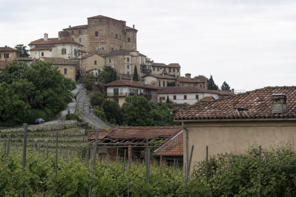
For a first visit, the Barolo Langa component is the one most people picture, and it is where the majority of guided e-bike tours run. If you are choosing a first ride, three formats cover the three zones well: a cellar-and-tasting tour out of Alba for the Barolo hills, the Neive-to-Barbaresco ride for the eastern ridge, and the Cisterna d'Asti loop for a taste of the Monferrato.
How Far Apart Are The Langhe Villages, Really?
Much closer than the map suggests. Every famous Barolo-zone village sits within about 20 km of Alba: Barolo itself is 13.9 km away, La Morra 15.8 km, Monforte d'Alba 19.6 km, Serralunga d'Alba 15.5 km. On the Barbaresco side, Neive is 13.4 km and Barbaresco 13.5 km. A fit rider on an e-bike can loop five or six of them in a single morning.
These are routed road distances, computed over the actual road network rather than straight lines, so they reflect what a cyclist or a driver genuinely covers. The compactness is the great secret of the area. Barolo to La Morra is 6 km; Barolo to Monforte d'Alba is 6.8 km. You could walk between some of the wine villages in an afternoon, and the classic full loop of the Barolo villages from Alba, taking in Grinzane Cavour, La Morra, Barolo, Novello, Monforte d'Alba, Serralunga d'Alba and Castiglione Falletto, measures only 67.9 km.
| Route | Distance | Notes |
|---|---|---|
| Alba → Grinzane Cavour | 7.5 km | The castle component, closest major sight |
| Alba → Neive | 13.4 km | Barbaresco zone starts here |
| Alba → Barbaresco | 13.5 km | The village, 600 residents |
| Alba → Barolo | 13.9 km | The village, 613 residents |
| Alba → Serralunga d'Alba | 15.5 km | The castle above the vines |
| Alba → La Morra | 15.8 km | The highest of the main villages |
| Alba → Monforte d'Alba | 19.6 km | Jazz festival town, southern edge |
| Barolo → La Morra | 6.0 km | Ridge-to-ridge link |
| Alba → Canale (Roero) | 14.4 km | Crosses the Tanaro |
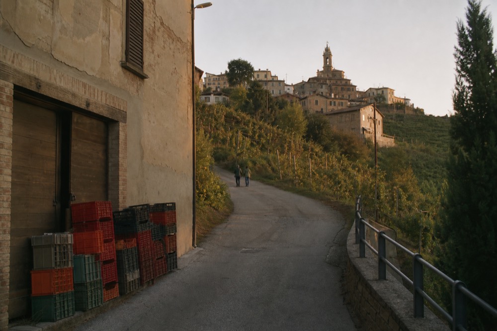
The consequence for planning is that you do not need to move hotels to see the region. Base yourself in or near Alba and the entire Barolo and Barbaresco zone is a short ride in every direction. The villages themselves are tiny, Barolo has 613 residents and Barbaresco 600, so the experience is of a dense cluster of small hilltop hamlets rather than a spread-out region. Our where to stay in Piedmont guide works through the base-town question in detail.
Where Do The Roero And Monferrato Sit On The Map?
The Roero sits directly north of Alba, across the Tanaro river, centred on Canale about 14 km away. The Monferrato sits east and south, around Asti, Nizza Monferrato and Canelli, stretching toward Alessandria. Both are quieter than the Langhe, receive fewer tour groups, and offer riding that is respectively sandier-ridged and more gently rolling.
The Tanaro river is the dividing line that matters most on any local map. South and west of it lie the Langhe, older marl and clay-limestone hills, smooth and terraced. North of it lies the Roero, younger and sandier ground, cut by the Rocche del Roero, a dramatic line of erosion cliffs and gullies that gives that side a completely different look. Canale, the Roero's main town, sits at 201 m; La Morra across the river stands at 508 m. The contrast is visible from the road within minutes of crossing the water.
The Monferrato is the third zone and the least visited by international tourists, though not by Italians. It runs east from Asti through Nizza Monferrato toward Canelli and Alessandria, and it holds two of the six UNESCO components: Nizza Monferrato and Barbera, and the Infernot cellars of the Alessandria portion. The Alba-to-Asti corridor along the Tanaro valley is the region's one genuinely flat ride, about 31 km with almost no climbing, which makes it the natural easy link between the Langhe and the Monferrato.
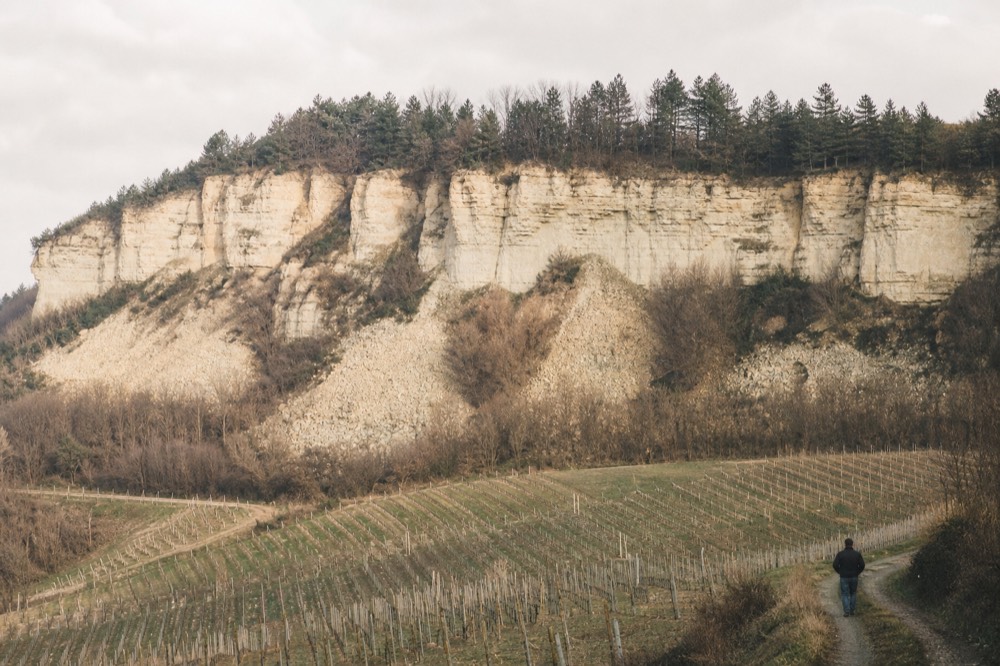
For cyclists, the Monferrato's signature experience is the infernot, a hand-dug underground cellar carved into the local sandstone, and one tour pairs a scenic ride with a visit to one of these secret cellars. The Monferrato Scenic Bike Tour and Infernot Secret Cellar Visit runs four to seven hours from $75 per person, a lower price point than the Langhe wine tours, and it suits riders who want landscape and curiosity rather than cellar-door tasting.
How Hilly Is Each Zone For A Cyclist?
The Langhe wine villages are rolling rather than brutal, but the Alta Langa behind them is genuinely mountainous. The classic Barolo villages loop climbs about 877 m over 67.9 km; the Barbaresco loop about 457 m over 35.6 km. The serious climbing starts south of the wine zone: the ride from Alba up to Mombarcaro gains about 1,040 m over 41.4 km, topping out near the region's surveyed high point of 896 m.
The elevation profile of the region has a shape that surprises people who have only seen the postcards. The working band runs from 139 m on the Tanaro at Alba up to 896 m at Mombarcaro's highest ground, locally called the roof of the Langhe. But the famous wine villages all sit in the middle of that range, between roughly 260 m and 508 m, linked by roads that roll rather than ramp. No verified gradient figures exist for any named climb in the area, so this site reports height gained, never percentages.
| Village | Centre elevation | Territory range |
|---|---|---|
| Alba | 179 m | 139–591 m |
| Barbaresco | 262 m | 136–331 m |
| Neive | 294 m | 140–451 m |
| Barolo | 303 m | 213–480 m |
| Castiglione Falletto | 349 m | 197–370 m |
| Serralunga d'Alba | 390 m | 202–446 m |
| Monforte d'Alba | 472 m | 213–561 m |
| La Morra | 508 m | 186–556 m |
| Mombarcaro (Alta Langa) | 886 m | 366–896 m |
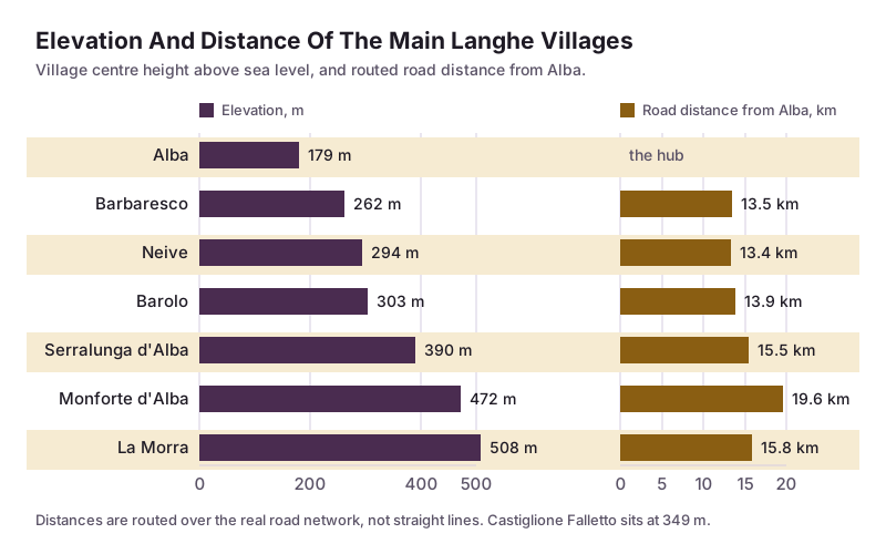
The takeaway for ride planning: the wine-village loops are e-bike-easy and road-bike-pleasant, while the Alta Langa behind them is a different proposition altogether. Riders who want the full contrast can take a private tour that mixes asphalt and dirt roads through the Barolo hills, the Langhe del Barolo private e-bike tour runs six to seven hours from $118 per person and is rated 5 across 29 reviews, one of the few listings in the region with enough reviews to carry a rating at all.
Where Should You Base Yourself On The Map?
Alba is the answer for most visitors. It sits at the centre of the wine map, 179 m up in the Tanaro valley, with Barolo 13.9 km one way, Barbaresco 13.5 km the other, and the Roero 14.4 km north. Asti suits travellers who want flat riding and rail links; a stay inside one of the wine villages suits riders who prize quiet and views over convenience.
Alba is the region's working hub, a town of 30,985 people, which by local standards is large: Barolo has 613 residents, Serralunga d'Alba 484. That size gap is the trade-off in map terms. Stay in Alba and you get restaurants, bike rental, the train station and every village within a half-hour ride. Stay in a village and you get the postcard, plus the need to ride back up the hill at the end of every dinner.
Asti, at 131 m and 73,604 residents, is the flat-lands option. The Alba-Asti corridor along the Tanaro registers almost no climbing over about 31 km, and Asti's station connects toward Turin. The trade-off is distance: from Asti you are 30 km from the Barolo hills, so it works best for riders happy to do a bigger loop or take a tour with a transfer.
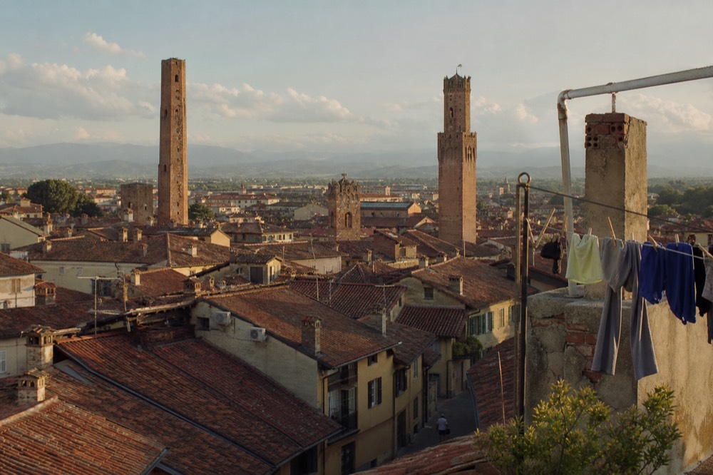
For a first-time visitor who wants wine, riding and logistics in one place, Alba wins, and an Alba-based tour is the simplest way to see whether the format suits you before committing to a multi-day plan. The Alba cellar e-bike tour runs about six hours from $186 per person, pairing the riding with a cellar tasting, and Check availability on the operator's live listing if the map logic points you to the Alba base.
What Cycling Infrastructure Is On The Map, And What Is Not Built Yet?
Less than the brochures imply. The headline project, a 32.5 km cycle route between Alba and Canelli branded the Ciclovia delle Colline Unesco, is funded with a 10 million euro regional grant but not built: works were due to be assigned by September 2026. There is no verified completed greenway between Alba and Bra, and no verified rideable-share figure for the VenTo Po-valley route. Ride the roads, not the press releases.
This is the point where a map and a marketing map diverge. The Comune di Alba's own announcement, on the council's news page, is unambiguous: the route is approved and funded, with a total project value of about 11.2 million euro including commune co-financing, and it was not rideable at announcement. Nothing since has confirmed construction has finished. Any source that puts a cyclist on that path today is wrong.
The same caution applies to the named routes that appear on tourism maps: the Bar to Bar loop around Barbaresco, reported in the press as a 124 km ring, and the VenTo route along the Po from Venice toward Turin, over 700 km in project terms, both exist as names and ambitions rather than as verified, signed, end-to-end paths. The riding that genuinely exists is on the region's quiet secondary roads, which are excellent, and on the strade bianche, the white gravel lanes that thread the vineyards. Our cycling in Piedmont roads and surfaces guide covers what those roads are actually like.
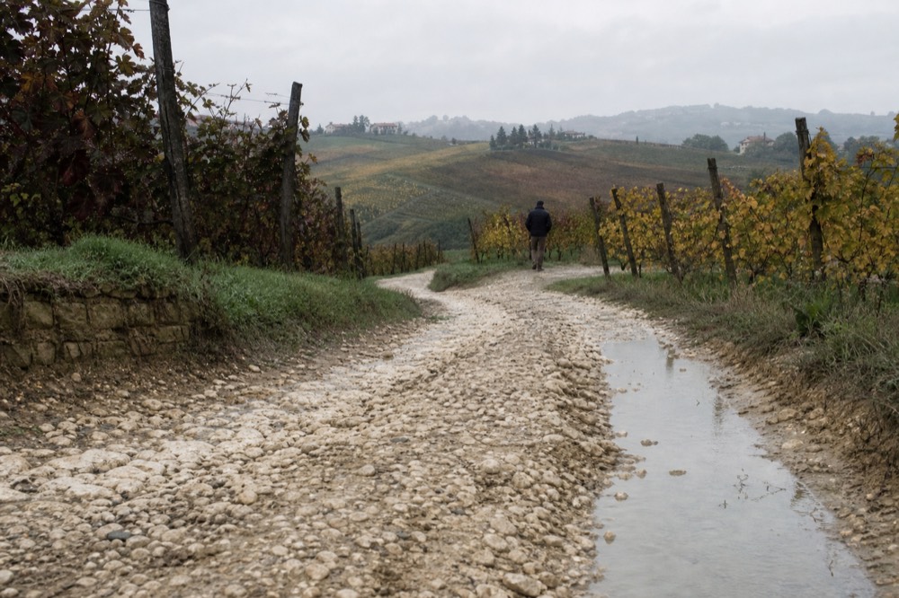
One piece of infrastructure does exist and is worth putting on your personal map: the train. Trenitalia regional services carry an assembled bike for a 3.50 euro supplement, valid until 23:59 on the ticket date, on trains marked with the bike pictogram, and folding bikes travel free. Direct trains link Turin and Alba in a little over an hour and a half, and the Alba-Asti line reopened in 2023, which means you can ride one zone and rail back from the other.
How Do Turin And The Airports Fit On The Map?
Turin sits 71 km north of Alba on the flat, about 55 minutes by road. Turin Caselle airport is roughly 90 km from Alba, Cuneo Levaldigi about 45 km but with few routes, and Milan Malpensa about 180 km and over two hours. Turin is worth a day or two of its own before or after the hills, and the train makes the Turin-Alba link easy without a car.
The airport arithmetic is the part of the Piedmont map most visitors get wrong. Milan's airports look close on a national map, but Malpensa is nearly 180 km from the wine hills and Bergamo is further still. Turin Caselle is the practical gateway, and it is growing: the airport handled 2.9 million passengers in the first half of 2026, up 17.3 percent year on year, and a new low-cost base opened there in September 2026.
| Gateway | Distance to Alba | Approximate drive |
|---|---|---|
| Cuneo Levaldigi (CUF) | 44.8 km | ~40 min |
| Turin Caselle (TRN) | 89.3 km | ~75 min |
| Milan Linate (LIN) | 162.3 km | ~2 h |
| Milan Malpensa (MXP) | 177.9 km | ~2 h 10 min |
| Bergamo Orio al Serio (BGY) | 217.1 km | ~2 h 35 min |
| Turin Porta Nuova station | 69.9 km | ~55 min |
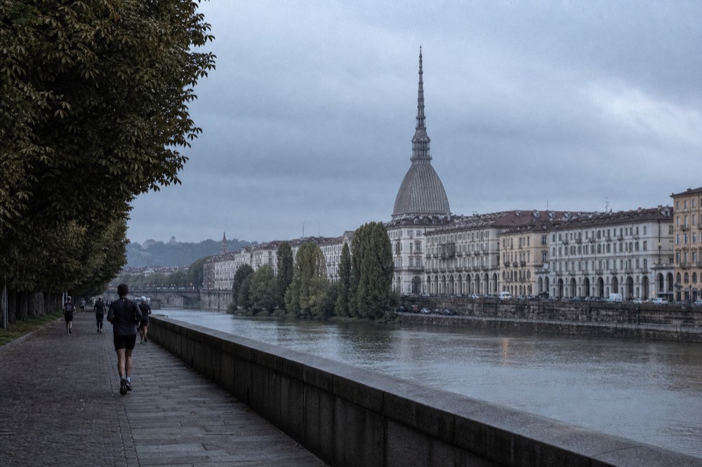
Turin itself deserves its place on the map rather than a drive-through. The city carries a cluster of bike tours, including a highlights-and-hidden-gems ride rated 4.8 across 144 reviews and an e-bike viewpoint tour rated 4.9 across 371 reviews, both from $45 per person, which makes an easy first or last day. The full city planning case, including how many days to give it, is in our day tours from Turin guide.
Which Zone Should You Book For Your Trip?
Book the Langhe, based in or near Alba, if this is a first visit or wine is the point: everything famous is within 20 km. Book the Roero if you want the same views with fewer groups and stranger geology. Book the Monferrato, around Asti or Nizza Monferrato, if you have already done the Langhe, prefer quieter roads, or want the region's flattest riding.
The honest summary of the map is that the three zones are close enough to mix and different enough to matter. A week in Alba lets you ride the Barolo hills twice, cross the Tanaro into the Roero once, and take the flat valley run to Asti on a tired-legs day. A week split between zones buys variety at the cost of packing and transfers that the map's short distances make unnecessary.
Timing matters as much as geography. September combines an average high of 23.6 degrees with the harvest, while November is the wettest month at 115 mm on average, and the white truffle fair runs from 10 October to 6 December. The full seasonal case, including the harvest calendar and the truffle season, is in our best time to visit Piedmont guide.
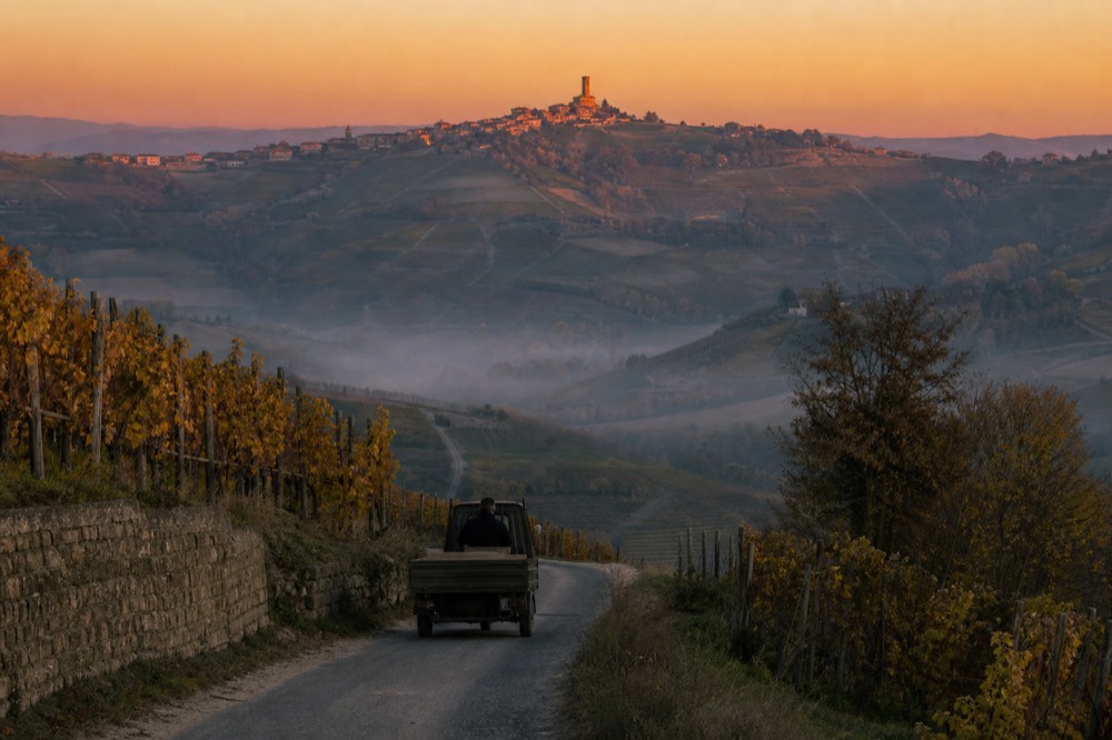
Whichever zone you choose, the tour formats follow the map closely: Alba-based cellar tours for the Barolo core, the Neive-to-Barbaresco ride for the eastern ridge, and the Cisterna d'Asti loop for the Monferrato. These three cover the geography of the region in a single day each.
This closing section gathers the six questions readers ask most about the Piedmont map, from the region's position in Italy's northwest corner to the distances between the wine villages, the choice of base town, the state of the region's cycle paths, and how Turin and its airports connect to the hills. Each answer below reuses the verified figures from the body of this guide.
Common Questions About The Piedmont Italy Map
Where exactly is Piedmont on the map of Italy?
Piedmont is in Italy's northwest corner, bordered by France and Switzerland and ringed by the Alps. Turin, the capital, sits on the Po plain in the north; the wine hills of the Langhe, Roero and Monferrato lie 70 to 90 km south of it around Alba, Asti and Canelli.
What are the three wine zones of southern Piedmont?
The Langhe south of the Tanaro river around Alba, the Roero north of the Tanaro around Canale, and the Monferrato east around Asti, Nizza Monferrato and Canelli. Together they form the UNESCO World Heritage property inscribed in 2014, six components covering 10,785 hectares.
How far apart are the Langhe villages?
Very close. Barolo is 13.9 km from Alba, La Morra 15.8 km, Monforte d'Alba 19.6 km, Barbaresco 13.5 km and Neive 13.4 km. The full loop of the Barolo villages from Alba measures only 67.9 km.
Which zone should I book for a first trip?
Base in or near Alba. It sits at the centre of the wine map with every famous village within about 20 km, plus restaurants, rental and a train station. From there you can reach the Roero and the Monferrato on day rides.
Is there a cycle path between the wine villages?
Not yet. A 32.5 km route between Alba and Canelli, the Ciclovia delle Colline Unesco, is funded with a 10 million euro regional grant, but works were only due to be assigned by September 2026 and no part is confirmed rideable. The riding that exists is on quiet secondary roads and gravel lanes.
How far is Turin from the wine hills?
About 71 km from Turin's centre to Alba, roughly 55 minutes by road, or a little over an hour and a half by direct regional train. Turin Caselle airport is roughly 90 km from Alba.